


Mairie de Baie-Mahault
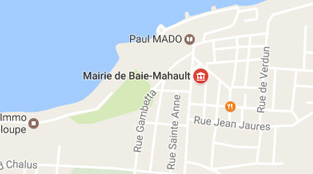
Place Childéric Trinqueur
97122 Baie Mahault
+ 590 (0)5 26 59 60
EXPERIENCE ITS TRUE NATURE
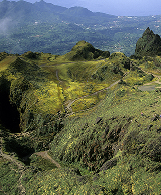
One of the two wings that make up the Guadeloupe butterfly, Basse-Terre is notable for the majestic silhouette of its Grande Dame, La Soufrière volcano, which rises 1467m above the tropical forest of Guadeloupe National Park. Walk among the treetops on rope bridges, or travel through time by journeying across Basse-Terre, where four centuries of history await you. Beaches, lush greenery, waterfalls... Basse-Terre invites you on a natural adventure!


Guadeloupe’s driving force
Located in eastern Basse-Terre and part of Greater Pointe-à-Pitre, Baie-Mahault serves as the gateway to the island for those coming from Grande-Terre. Considered the archipelago’s economic powerhouse, Baie-Mahault is today the vital center of Guadeloupe.
Originally named the Marquisate of Houêlbourg after its first governor, Charles Houêl, the town was rechristened Baie-Mahault in the 18th century in reference to the mahoe, a type of mangrove tree used to make rope for sailing ships.
It includes the Guadeloupe International Airport as well as the Jarry business district, which you’re bound to experience.
Size4 400 HA
Number of inhabitants23 389
Place Childéric Trinqueur
97122 Baie Mahault
+ 590 (0)5 26 59 60
A place of history and knowledge
Located in the southwestern part of the island and considered a suburb of Basse-Terre city, the town of Baillif was formed in 1637 and lies between the Les Pères and Baillif rivers.
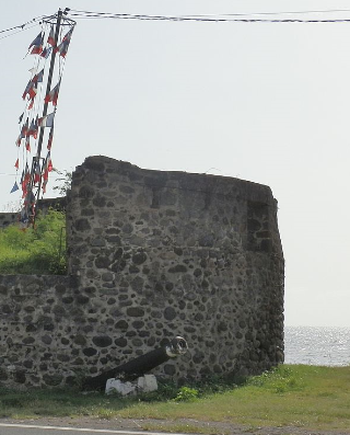
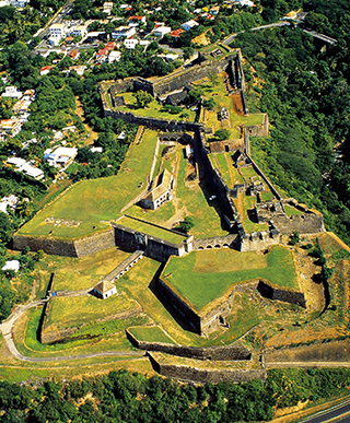
If you follow national route 2 connecting the city of Basse-Terre to Pointe-Noire, you’ll spy the Père Labat Tower. It was originally part of several fortresses built in Baillif to protect the region against an invasion by the English, and was officially designated an historic monument in 1979.
Baillif is today home to a commercial and industrial district that rivals the one in Jarry, where you can dine and do your shopping as well. It also includes a small regional airport, making Baillif an ideal launching point for the islands to the south.
Size2 430 HA
Number of inhabitants5 837
Le Bourg
97123 Baillif
+ 590 (0)5 99 11 70
ville-de-baillif@wanadoo.fr
Le Bourg
97123 Baillif
+ 590 (0)5 99 11 70
baillifstep@yahoo.fr
A city of art and history
The city of Basse-Terre, Guadeloupe’s administrative capital, derives its name from its geographical site and from a sailing term that means a place protected from wind. Located at the foot of the famous La Soufrière volcano, Basse-Terre is especially rich in history.
Charles Houël, governor and seneschal of Guadeloupe, purchased the land in 1643 from the Compagnie des Isles d’Amérique and ordered the construction of a fort, forcing residents to move to the opposite bank of the nearby river. In 1702 the English set fire to the city and occupied it for seven years, an event that spurred the growth of Pointe-à-Pitre. The Second World War accelerated the city’s decline.
Now officially designated by France a City of Art and History, Basse-Terre is a perfect example of Creole architecture since the arrival of the first colonists. And if you’re keen on history and culture, pay a visit to Notre Dame de Guadeloupe cathedral, one of the oldest in the islands.
A community in constant change, Basse-Terre offers both a traditional picture of Guadeloupe as well as its more contemporary side!
Size578 HA
Number of inhabitants12 410
Cours Nolivos
97100 Basse-Terre
+ 590 (0)5 80 56 48
contact@ville-basseterre.fr
46 Rue Paul Baudot
97100 Basse-Terre
+590 (0)5 90 86 05 81
otisbt@hotmail.fr
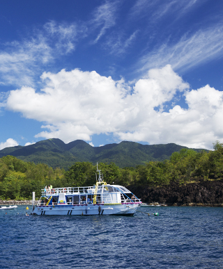
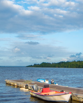
The must-see for deep-sea divers
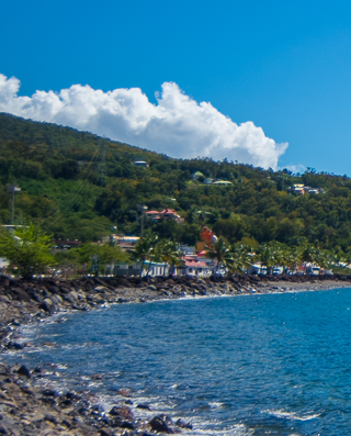
Bouillante – Guadeloupe’s center for scuba diving, big-game fishing and tourism on the leeward coast – is one of the oldest communities in the archipelago. Named for its hot springs, Bouillante offers some serious attractions for tourists!
It’s world-renowned for the Cousteau Reserve, the deep-sea diving site off Pigeon Islet, as well as for the bay of Anse à la Barque, long-time home to buccaneers and considered one of the safest places in Guadeloupe during a hurricane. Still largely undeveloped, the bay will entrance you with its natural charm, what with its lush green mountains and deep blue sea!
Bouillante is also the site of a geothermal power plant showcasing French technology, along with the Parc Zoologique des Mamelles, truly a modern-day Noah’s ark that is home to some 85 animal species from the Caribbean and Guyana.
You can also visit its church, which dates from 1827 and was built with the financial support of local landowners, who at that time were raising crops ranging from coffee and cocoa to vanilla, cotton and tobacco.
Size6 973 HA
Number of inhabitants7 336
Hôtel-de-Ville
97125 Bouillante
+ 590 (0)5 98 70 04
bouillante.ville@wanadoo.fr
Le Bourg
97125 Bouillante
+590 (0)5 90 98 73 48
office.tourisme@ville-bouillante.fr
Where Christopher Columbus came on shore...
It was in this region, at a site called Sainte-Marie, that Christopher Columbus landed on November 4, 1493 at the time of his second voyage. Known for the richness of its soil, Capesterre Belle Eau has an economy primarily focused on agriculture. If the mood takes you, visit the banana and sugar cane plantations nearby, or stop by the Fabrique de Sirop de Batterie Moysan to sample the famous sugar cane syrup!
When slavery was abolished in 1848, the Indian workers who replaced the black slaves erected the Changy temple, one of Guadeloupe’s most beautiful Hindu temples and a genuine curiosity in this tropical landscape; visitors are permitted under certain conditions.
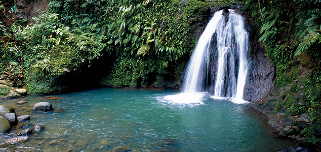
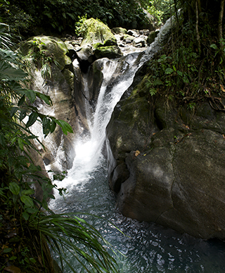
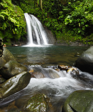
Don’t miss the celebrated Chutes du Carbet, one of the most impressive waterfalls to be found in the Lesser Antilles!
Size10 300 HA
Number of inhabitants19 568
Avenue Paul-Lacavé
97130 Capesterre-Belle-Eau
+ 590 (0)5 86 42 23
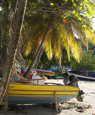
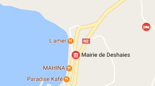
A wildly colorful village
With its ideal seaside location on the northwest side of Basse-Terre, this fishing village was once cut off from civilization until a road was opened connecting it to the neighbouring town of Pointe-Noire.
Pirates and other buccaneers put Deshaies on the map, thanks to its proximity to the islands of Montserrat and Antigua. In 1804 the local population chose to leave the village rather than accept occupation. Today its economy is based on agriculture, including cocoa, coffee and vanilla; the local vanilla oil is sought after worldwide.
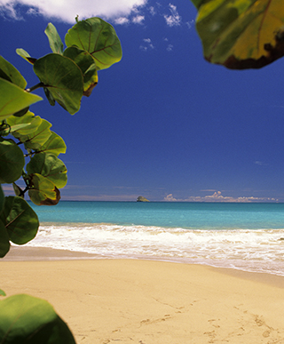
You’ll find one of Guadeloupe’s most beautiful beaches in the historic district of Grande-Anse, which is also home to the town’s first church as well as numerous bays and inlets. If you’re looking for a tranquil, picturesque site, Deshaies is paradise!
Size3 111 HA
Number of inhabitants4 039
238 boulevard des Poissonniers
97126 Deshaies
+ 590 (0)5 28 50 27
secretariat.deshaies@hotmail.fr
Rue de la Liberté
97126 Deshaies
+590 (0)5 90 68 01 48
sideshaies@wanadoo.fr
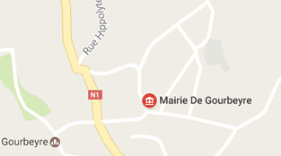
The water city
This peaceful community in southern Basse-Terre offers the only passageway between the windward and leeward sides of the island. It’s name for Admiral Gourbeyre, who organised rescue efforts for the local residents after the earthquake of 8 February 1843.
As the home to numerous religious communities since the 17th century, including the Carmelites in Dolé, the Brothers of Charity in St Charles and the Jesuits in Bisdary, Goubeyre was at the forefront of the revolutionary struggle, and it was only in 1837 that this so-called “Donkey’s Back” region was recognised as an official district.
Offering mineral water springs, spas and numerous hiking trails, Gourbeyre is a place where calm, tranquility and living well go hand in hand.
Size2 252 HA
Number of inhabitants7 642
Avenue Louis-Philippe-Longueteau
97113 Gourbeyre
+ 590 (0)5 92 28 62
gourbeyre.sg@wanadoo.fr
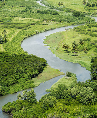
The town along the rivers
The parish of Goyave was originally known as “St Anne of the Little Guava River” because of the abundant wild guava that can be found along the region’s main rivers.
Once a place of hard labour and the site of numerous public executions of rebel slaves, Goyave is today an agricultural centre that is home to many farms.
If you’re looking for something different and exotic, such as the Moreau waterfalls at Sainte-Claire beach or the aquatic gardens on the islet of Fortune, come visit this unspoiled region!
Size5 830 HA
Number of inhabitants5 060
Rue des Écoles
97128 Goyave
+ 590 (0)5 95 88 21
Culture and agriculture!
It was the manatee (“lamantin” in French), that small, herbivorous sea mammal that for a time had disappeared from the Lesser Antilles (but will soon be reintroduced!) that lent its name to this community in northern Basse-Terre. Part of Greater Pointe-à-Pitre, the town is located between the bay of the Grand Cul-de-Sac Marin and the mouth of the Goyave River in northern Basse-Terre.
An agricultural region par excellence, Lamentin is famed not just for its fertile land but for being Guadeloupe’s premier destination for art and culture.
Bordered by mangrove trees, swamp forests and grassy marshland, the Grand Cul-de-Sac Marin Nature Reserve spans more than 15,000 hectares and offers something to appeal to every visitor.
And if you need to recover a bit afterwards, the Ravine Chaude hot springs await. The waters come directly from the highlands of the Lézarde River, near La Soufrière volcano.
Size6 493 HA
Number of inhabitants13 434
Rue de la République
97129 Le Lamentin
+ 590 (0)5 25 36 25
Le Lamentin
97129 + 590 (0)5 42 35 87
otl@mairie-lelamentin.fr
Hugely appealing
Overlooking the Grand Cul-de-Sac Marin between the Caribbean Sea and the Basse-Terre volcanic massif, Petit-Bourg – once known as Petit-Cul-de-Sac – is Guadeloupe’s largest district (commune) by size.
It was formerly a well-known stagecoach stop between Basse-Terre town and Pointe-à-Pitre. Thanks to its port, which was one of Guadeloupe’s busiest during the 18th century, the town was briefly home to the Guadeloupe Colonial Assembly in 1787 before its move to Basse-Terre in 1790. In the years since 1950 the town has attracted some notable residents as well as a new middle class that have built homes there.
Today, Petit-Bourg serves as a gateway to numerous excursions while offering quality eco-friendly resorts that provide a charming change of pace!
Size12 556 HA
Number of inhabitants20 528
Rue Schoelcher
97170 Petit-Bourg
+ 590 (0)5 90 95 38 00
97170 Petit-Bourg
+ 590 (0)5 90 60 12 31
www.tourisme-petitbourg.fr
Authentic appeal
The district of Pointe-Noire, established around 1715, gets its name from the ubiquitous black volcanic rock. Long isolated from its neighbours, Pointe-Noire retained a reputation for rebellion and protest, but it’s best known as a place where traditions die hard!
With its gray-sand beaches, waterfalls, aquaculture centre and museums – not to mention its gardens, parks and authentic plantations – Pointe-Noire has become an essential stop on any itinerary.
Size5 845 HA
Number of inhabitants7 689
383 place de la Liberté
97116 Pointe-Noire
+ 590 (0)5 98 01 04
sd.pointe-noire.97116@orange.fr
Route des Plaines
97116 Pointe-Noire
+ 590 (0)5 99 92 43
www.pointe-noire.org
Home to water and greenery
Lying at an altitude of 530 m, Saint-Claude is the highest community in the Lesser Antilles. Nicknamed the Volcano City because of its geographical location, Saint-Claude has been a farming region since the early colonial period, producing mainly coffee and sugar cane.
It’s been the site of numerous historical events, notably in Matouba, where black officers once chose to kill themselves rather than submit to slavery.
Now a bedroom community for Basse-Terre, Saint-Claude enjoys a healthy climate, with sulphurous waters that are known throughout Guadeloupe for their miraculous healing properties.
With its thermal spring water, numerous hiking trails and excursions to La Soufrière volcano, Saint-Claude is Guadeloupe’s undisputed capital of ecotourism, offering a fresh perspective on the Caribbean!
Size3 430 HA
Number of inhabitants10 327
Rue Maréchal
97120 Saint-Claude
+ 590 (0)5 80 00 16
cabinet.stclaude@wanadoo.fr
www.ville-saintclaude.fr
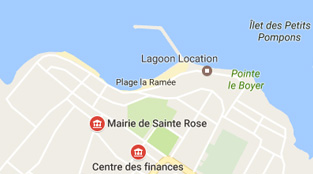
Where traditions and authenticity come together!
Sainte-Rose owes its name to St Rose of Lima, the patron saint of the Americas, the Philippines, Peru and the city of Lima. Pressed against a mountainside in northern Basse-Terre, the town was divvied up into sections during the 18th century, with one for each of the major sugar plantations. Sugar cane fields came to replace the once-dominant tobacco and cotton crops.
Sainte-Rose’s distilleries are a testament to this colonial legacy of sugar and rum, and are not to be missed! For visitors who love to hike, the area offers countless paths for exploring the tropical forests, with their extraordinary plant and animal life. And for a wellness break, what would you say to a bath in the beneficial sulphurous waters of Sofaia, known for their calming properties?
Boasting distilleries and museums, hiking and excursions to the Grand Cul-de-Sac Marin, Sainte-Rose is a place where traditions and authenticity come together!
Size11 800 HA
Number of inhabitants17 574
Avenue Sainte-Rose-de-Lima
97115 Sainte-Rose
+ 590 (0)5 28 05 50
rbriert@villesainterose.fr
Esplanade de verdure, Place Tricolore
97115 Sainte-Rose
+ 590 (0)5 68 00 00
From pre-Columbian civilisation to sugar cane plantations...
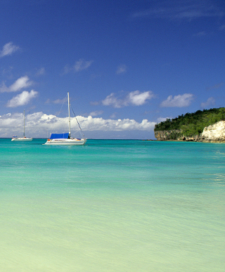
As you might guess, Trois-Rivières lies at the intersection of three rivers: the Trou aux Chiens, the Petit Carbet and the Grande Anse. Located between sea and mountainside in southern Basse-Terre, the town can point to numerous assets.
Since 1640, its extremely fertile soil was first used to grow cassava and yams, and later tobacco, cotton, vanilla and coffee, before finally being given over to sugar cane in the 18th century.
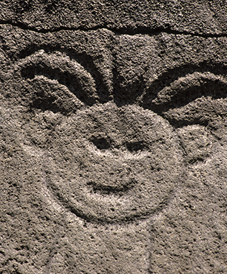
As a cradle of pre-Columbian civilisation, Trois-Rivières is also home to the fascinating Parc Archéologique des Roches Gravées, named a historic monument in 2013.
From the beach at Grande-Anse to the Banana Museum, from a simple seaside stroll to an inland hike... there’s no doubt that Trois-Rivières has something to offer everyone!
Size2 934 HA
Number of inhabitants8 738
Place du Capitaine-Moïse-Bébel
97114 Trois-Rivières
+ 590 (0)5 90 92 90 05
mairie.trois.rivieres@wanadoo.fr
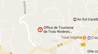
3 rue Gerville Réache
97114 Trois-Rivières
+ 590 (0)5 90 92 77 01
odttr114@orange.fr
www.troisrivieres971.com
A centre of embroidery
Vieux-Fort has recently emerged as a highly popular spot among surfers! Located on the southern end of Basse-Terre between its windward and leeward coasts, the town is strategically placed. Once the home of a pre-Columbian population that was displaced by French colonists, the town initially arose around food and vegetable gardens.
Built in 1936 for the colony’s defence, Vieux-Fort became a center for traditional embroidery in 1980 and now warmly welcomes visitors.
With its surfing opportunities, its town clock – the oldest on the island – and its celebrated lighthouse, which began operating in 1955 and marks the entrance to the Basse-Terre harbor, the community of Vieux-Fort certainly isn’t lacking in attractions!
Size714 HA
Number of inhabitants1 617
Place Marie-Eusèbe
97141 Vieux-Fort
+ 590 (0) 5 92 00 00
mairie@ville-vieux-fort.fr
Land of the Valleys
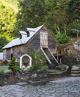
Vieux-Habitants is home to the oldest church in Guadeloupe. Located in the western part of Basse-Terre island, this small windward community holds plenty of surprises!
Erected in the early 1700s on the site of an earlier chapel built by Dominican friars, Saint Joseph’s church is notable for its multi-roof bell tower, constructed by builders hailing from France’s Limousin region.
Vieux-Habitants was one of the first areas occupied by the French during the early period of colonization, and as various archaeological discoveries from the Duplessis riverbed have shown, the Caribs inhabited the site as well.
In the 1700s, indigo, cotton and tobacco plantations gave way to coffee production, which is ideally suited to the region. Be sure to tour the original Habitation de la Grivelière coffee plantation and taste one of the world’s best arabica coffees!
From its unusual church to its small natural port – an ideal spot for a pleasure boat ride – Vieux-Habitants offers any number of reasons to stop and stay a while.
Size5 870 HA
Number of inhabitants7 611
Avenue du Gouverneur Général Félix-Éboué
97119 Vieux-Habitants
+ 590 (0)5 98 42 02
secret.vieuxhabitants@orange.fr
Boulevard des Habissois Souverains
97119 Vieux-Habitants
+ 590 (0)5 98 33 43
www.vieuxhabitants.com